ABOUT THE SYSTEM
Key features of our system
High-Resolution Analysis
High Robustness
High Accuracy
Pixel Level Video Stabilization
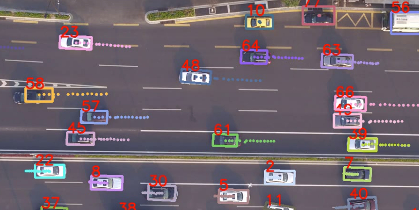
Car Pose Estimation
Lost and Missing Vehicles Re-matching
Semantic Segmentation
Fusion of Deep Learning and Traditional Method
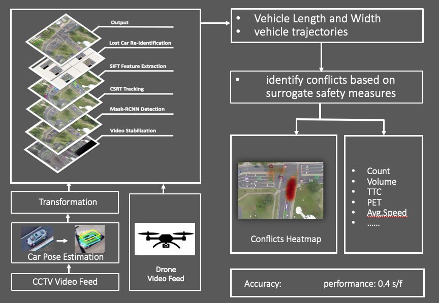
System Overview
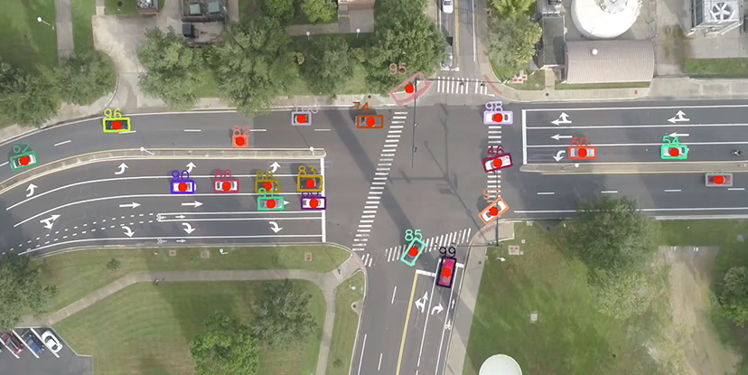
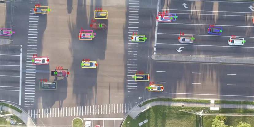
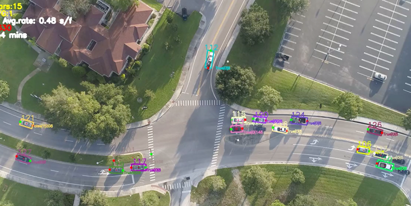
This system, applicable in particular to road traffic analysis, uses drone/Unmanned Aerial Vehicle (UAV) videos. Video data from drones/UAVs are stabilized first, and then be processed through the automatic detection and tracking system based on state-of-the-art algorithms. This system also further corrects vehicles' tracking areas based on vehicles' moving conditions and detection results to provide more accurate outputs, especially for turning vehicles. Based on the detection and tracking results, the systems can generate the following types of outputs using drone/UAV video data:
- --Trajectory data of road users including vehicles and vulnerable road users
- --Road users' classifications
- --Traffic statistics (e.g., volume, speed)
- --Safety indicators (e.g., Post-Encroachment Time (PET))
The system can be applied for drone videos that are collected from different types of roadways, including freeway, arterial, and intersection.
System Demo
Hours Testing
Sample Size
publication
Univerisity partners
THE TEAM
The ones who makes this happen
Dr. Mohamed Abdel-Aty
P.E., F.ASCE Trustee Chair

Dr. Yina Wu
Research Associate Professor

Ou Zheng
Computer Vision Research Engineer

Dr. Qing Cai
Research Assistant Professor
Our Performance.
Accuracy
Expected Average Overlap(EAO)
Robustness
OUR Example
What we've done for safety